Travel planner evolved

Plan, Map, and Chronicle Your Journeys — Fully Offline & Securely

Adventures is a geography-first visual travel planner built for rugged explorers, agencies, and group travelers. Manage complex multi-leg rail routes, track cross-border budgets, and record travel logs on map pins.

Designed for Modern Explorers

Our interface blends a sleek, dark glassmorphic design system with highly functional components. Click any interface screenshot to expand and explore the features.
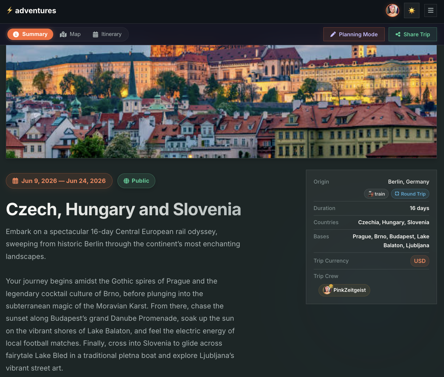
Adventures Trip Overview Screen

Trip Overview

A unified calendar dashboard showcasing shiftable timelines, base cities list, accumulated nights, lodging summary, and currency-converted budget cards.
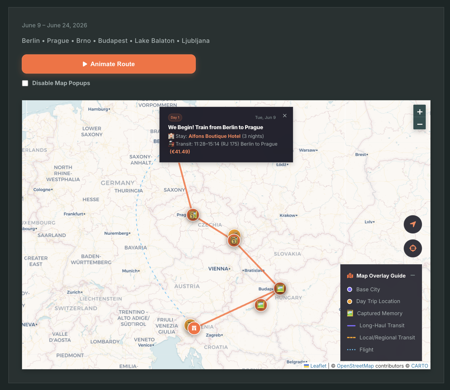
Adventures Trip Map Screen

Interactive Journey Map

Geography-first planning driven by Leaflet JS mapping. Displays solid routes for train/bus links, dashed routes for day trips, and Bezier curves for flights.
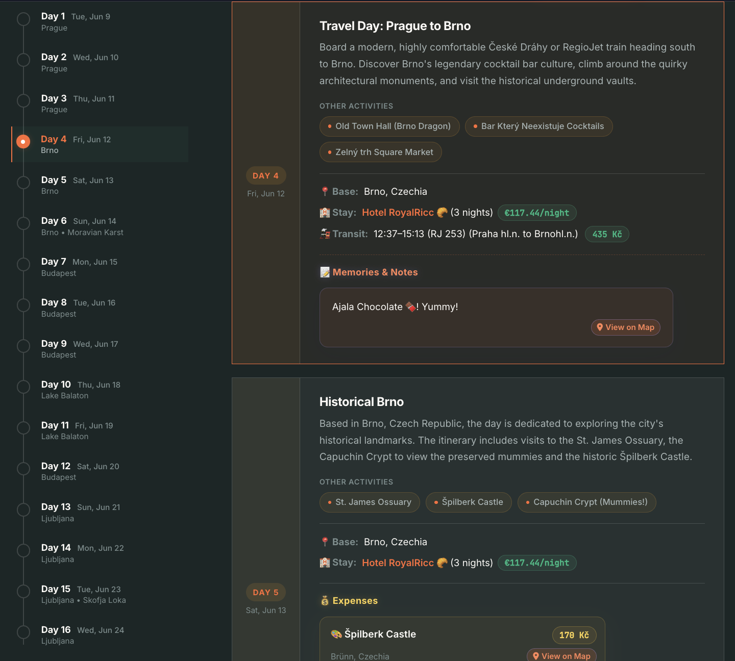
Adventures Detailed Itinerary Screen

Detailed Itinerary

Day-by-day chronological timeline of transit legs, lodging nights, activities, and duration badges. Powered by SortableJS for responsive drag-and-drop reordering.

Built for the Journey Ahead

From tunnels to cross-border journeys, Adventures is loaded with advanced capabilities that elevate it from a spreadsheet to a premium digital travel companion.

Geography-First Visual Planning

No more static lists. Visualize routes on a high-contrast map with custom wrappers. Distinguish between base city hotel nodes and excursions. Watch route paths update as you plan or reorder itinerary sequences.

100% Offline Map Caching

Internet drops are inevitable on regional trains, planes, and tunnels. Our PWA uses a Service Worker to cache geographical tiles from CartoDB/OpenStreetMap in a dedicated local database, keeping map grids fully interactive without signal.

Smart Multi-Currency Budgeting

Traveling across borders often means navigating multiple local currencies. Record purchases, allocate expenses, and track your total spend converted on the fly to your base currency, with visual indicators mapping where costs are incurred.

Seamless Group Collaboration

Invite fellow travelers or tour guides as Collaborators to modify timelines, post expenses, and plan together, or share read-only links with viewers for an elegant presentation of the final travel structure.

Zero Compromise on Privacy

Your travel history, bookings, and personal diaries are private. We've built Adventures with robust security layers protecting your active data.

Cryptographically Protected

Adventures uses enterprise-level security measures to protect your sessions, coordinates, and personal logs.

  • Crypto-Secure Sessions

    Cryptographically generated 32-byte session tokens with a strict 30-day database persistence policy secure every user profile.

  • Collaborator Role Middleware

    API endpoints utilize robust access-checking logic to strictly validate owners, editors, and viewers, throwing discrete `404 Not Found` returns to hide private trip visibility.

  • Enforced API Payload Filters

    Private elements like text journals and pin descriptions are filtered on the server. Non-authorized requests get zero access to memory metadata, avoiding client-side leakage.

  • Anonymous Nickname Generators

    New accounts and default profiles are assigned clean, anonymous nicknames generated via custom algorithm lists, protecting your raw email identification by default.

Your Data, Your Way

No lock-ins. You completely own all your travel itineraries, expenses, and logs. Move data in and out of Adventures seamlessly.

Complete Data Ownership

We believe your data belongs to you. Export your complete trip structures, coordinates, currencies, lodgings, transit details, and text memories in clean, structured JSON files at any point. You can save, backup, or analyze your trip details without boundaries.

AI-Powered Plan Importing

Planned a trip with Gemini, Claude, or ChatGPT? Simply feed the AI model our structural format instructions, download the generated JSON file, and upload or paste it straight into our raw importer to load and visualize your externally-planned itinerary in seconds.

A Living Record of Your Journeys

Traditional travel planners throw away details once the trip concludes. Adventures preserves your travels in an interactive scrapbook that you can look back on forever.

Coordinate-Linked Memories

Drop memory marker pins directly onto the Leaflet map canvas at exact GPS coordinates. Add photos, thoughts, or observations from the field.

Interactive Camera Panning

Chronological text journal entries tie back to specific days. Tapping a journal memory initiates smooth camera panning and zooms directly to the origin on the journey map.

Journal Sample
📸

Sunset at the Alpine Pass

Day 4 • 20:14 PM • Lat: 46.54, Lng: 8.72

"Hiked up the trail after checking in to our base hotel. The weather cleared up completely and the view across the pass was absolutely stunning. Tapped this memory pin right at the ridge where we sat down. Offline GPS map saved us when the path markers faded."

🔒 Visible only to collaborators View on Map

Ready to start your next adventure?

Join group travelers, rail explorers, and solo adventurers who map their pathways, track expenses, and lock in travel logs securely.

Launch Free Trip Planner